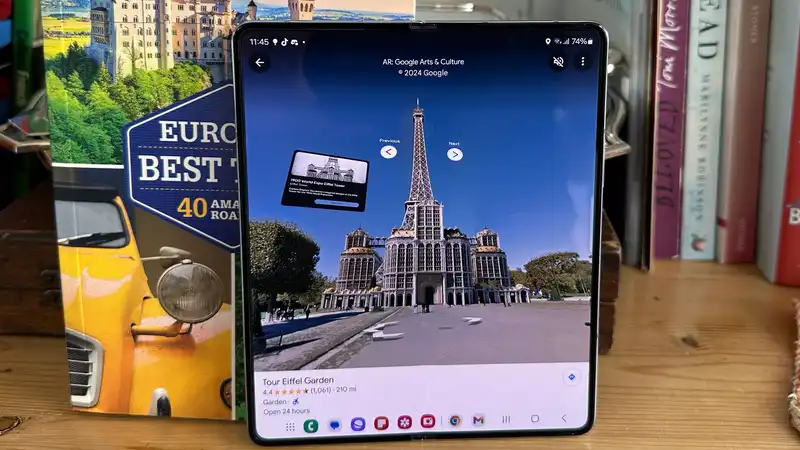
Google has announced a new AR feature for Google Maps that offers a unique way to explore landmarks
The new Augmented Reality feature of Google Maps uses a Google Lens to show how famous landmarks looked in the past Now users can use their cell phones to view interactive information cards detailing the history of famous landmarks in Paris, such as the Eiffel Tower in the 1900s
To use this feature, point the device at the tower in the real world and select the AR function Street View also allows visitors to see the past from anywhere in the world Google states, "You can visit Notre Dame Cathedral and its surroundings as they were in 1789, recreate the Bastille Saint-Antoine in 3D before the French Revolution, or tour the Tuileries Palace before it was demolished hundreds of years ago"
If all of this sounds vaguely familiar, it may be because Google worked with Ubisoft, developer of the "Assassin's Creed" series, in conjunction with Google Arts & Culture Google's gaming dreams may have ended with Stadia, but it is great to see the company using its connections to implement exciting new features on other properties
Google has been pushing to improve the user experience recently, with the latest update adding accessibility alerts to routes and working to make trip planning easier The company is also working on an overall redesign, with more changes reportedly on the way These upcoming design changes include eliminating the full-screen menu and replacing it with a new sheet-based layout
Using AR to recreate historical buildings may not be a feature that appeals to everyone, but it will be appealing to history buffs and those who want to learn more about the city's landmarks The AR experience is currently limited, but it is probably only a matter of time before landmarks other than Paris are added
For more advice on Google Maps, see our full list of 9 Hidden Features You Need to Know


Comments